
Geographic Boundaries and Land Borders
The Orange River as a Natural Border
The Orange River is not a polite boundary. It is a 2,200 kilometre assertion of geography that defines the southern flank of the northern cape borders. This river, the longest in South Africa, forces a natural division, separating the Free State and Eastern Cape, while also demarcating the border with Namibia to the west.
Along its course, the river cuts through arid terrain, creating a stark line of green in a landscape of ochre and stone. Farmers on the north bank are not automatically free from Northern Cape regulations, as border enforcement follows the river’s thalweg, or deepest channel.
The border’s practical functions include:
- Water resource allocation between provinces
- Control of cross-border livestock movement
- Management of fishing and riparian rights
A river border is not static. Seasonal floods shift the channel, requiring surveyance to keep the boundary accurate. The northern cape borders involve a river that demands constant attention.
The Border with Namibia
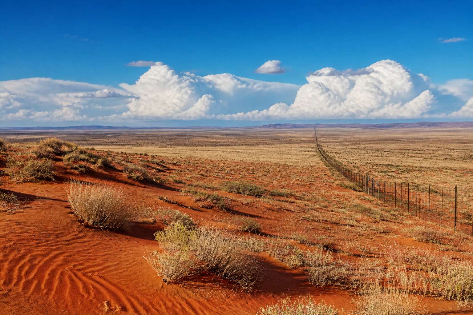
North of the river, the northern cape borders shift from water to a straight line scored through Kalahari scrub. This is a boundary you can walk across, though few do. The land is empty, marked by fence posts and survey beacons rather than any obvious natural feature.
The main crossing at Nakop funnels N8 traffic through to Upington, while smaller posts like Onseepkans and Velloorsdrif serve farmers and local trade. Each one operates on its own rhythm, and travellers carry a particular awareness of distance here.
- Nakop: the busiest land port
- Onseepkans: limited weekday hours
- Velloorsdrif: quiet, seasonal, often deserted
These crossings matter for livestock movement, goods, and families split across the two nations. The border is long, but its gates are few, which gives the whole frontier a measured, deliberate pace.
The Border with Botswana
The border with Botswana is not a fence. It is a surveyed line through the Kalahari, and the Kalahari does not care. This section of the northern cape borders follows the Molopo River when the river has water, then abandons it for a straight line of survey beacons. On paper it looks deliberate. On the ground, it looks like someone gave up.
Crossings are few and functional:
- McCarthy’s Rest, a working post for trucks and the occasional lost tourist.
- Bray, where the border post shares space with a general dealer and a spirited debate about whose clock is correct.
The northern cape borders remain quiet on this side. Livestock moves, families cross, and the road stretches without landmarks to argue with the map. You drive until the gravel gives out, then you are either in Botswana or you are not. Pack your passport, a full tank, and patience.
Provincial Border Delineations
The Border with the Western Cape
The border with the Western Cape is the least ceremonious of the northern cape borders. It has no river to mark it and no toll gate to confirm it. The line simply exists, drawn across a plateau where the soil turns a paler red.
This demarcation follows the old logic of rainfall and mountain runoff. It separates the Northern Cape’s aridity from the Western Cape’s wetter climate. The transition is so gradual that I often realise I have crossed it only when I stop for coffee and the barista asks about the weather in a distinctly different accent!
Practical signs of the change are everywhere:
– The farm gates become wooden instead of steel.
– The wind carries a coastal chill.
– The speed limits drop without warning.
These small shifts define the northern cape borders more accurately than any map.
The Border with the Eastern Cape
The border with the Eastern Cape is the quietest of the northern cape borders. It runs through the Karoo heartland without a gate, a bridge, or a checkpoint. The horizon stays flat and the fences keep going. The transition is geological before it is political. The pale red sand gives way to darker, denser soil. The koppies shrink. The sheep remain, but the farms change character.
I notice the shift when the farm gates turn from steel to wood, and again when the roadside succulents disappear. Then I know I have crossed.
Where other northern cape borders rely on rivers, this one depends on small signs. Useful markers along this boundary:
- Noupoort, the railway town that marks the western approach.
- The long gravel stretches that belong to neither province.
- The sudden appearance of aloes against the hill slopes.
Those quiet indicators matter. The Eastern Cape border does not announce itself. It simply lets the landscape do the talking.
The Border with the Free State
The Free State border is the one northern cape borders enthusiasts love to argue about, because it is the only one that arrives with a water feature. The Orange River does the heavy lifting here, but unlike the Namibian stretch, this boundary is less about vast emptiness and more about infrastructure. Before the Gariep Dam was built in 1971, the border was just a river. Now, it is a reservoir that drowns the old riverbed and occasionally drowns a farm road that was mapped before the flood. The transition is abrupt: one minute you are on the arid N1 heading north, the next you are crossing the Hendrik Verwoerd Dam and the landscape turns green, almost aggressively so.
The shift is noticeable in the soil, which changes from gritty Kalahari sand to the dark, clay-heavy earth that Free State farmers swear by. The towns along this border, such as Colesberg and Philippolis, act as vestibules for travelers, but the actual line is often a single fence on the horizon.
Useful markers along the way:
– The Gariep Dam wall, which is the largest in the country.
– The N1 bridge at the dam.
– The sudden appearance of maize fields where sheep grazing used to be.
– The old railway siding at Norvalspont, which predates the dam.
These elements do not announce the border. They simply change the texture of the landscape, and the northern cape borders fade into a new province without a formal greeting.
The Border with the North West
Few travellers notice where the Northern Cape yields to North West. The border begins as a bend in the Vaal River at Warrenton, follows the water north past Christiana, then abandons the river entirely. From there, the line is a surveyor’s straight edge across the dry savanna, a corridor of thornveld that once divided the Tswana homeland of Bophuthatswana from the rest of the country.
State roads cross it without fanfare. Near Kraaipan, the N18 slips through, its only marker a faded provincial sign. The towns anchor each side: Kuruman in the Northern Cape, Vryburg in North West. Both draw cattle farmers, yet the provinces enforce different tax laws and school calendars.
This is one of the northern cape borders defined by political history rather than rivers. The transition shows in soil and stone. Red Kalahari sand gives way to harder, darker earth, and the acacia thickens.
The Atlantic Coastline as a Western Border
The Northern Cape’s Atlantic coastline stretches roughly 300 kilometres, a western border defined not by surveyors but by the ocean’s own insistence. I have stood at the Groen River mouth, watching the cold Benguela current slap against a shore that seems reluctant to exit the desert. This boundary follows the high-water mark, an ever shifting line that cartographers fix on official maps yet nature redraws with every spring tide. The provincial delineation treats this coast as a simple cut, but the ocean disagrees.
What sets this frontier apart from other northern cape borders is the absence of any human marker. No border post, no fence, no road. The Atlantic simply terminates the arid plains. Towns like Hondeklip Bay persist along this edge, their livelihoods dependent on fish and diamonds pried from the sea’s cold generosity. This border offers no passage, only a pause between two worlds.
Border Towns and Economic Hubs
Nakop: The Gateway to Namibia
A quiet day at Nakop is a myth! Customs officials who work this dusty stretch of the N10 will tell you that. This border post stands as the primary overland gateway between South Africa and Namibia, funneling trucks and travellers across the northern cape borders.
The economic activity here is steady. Goods moving between Walvis Bay and Johannesburg pass through Nakop, and the volumes shape local livelihoods. Workshops, fuel stations, and modest eateries cluster near the gate, serving drivers who know the route by heart.
- Manganese ore from the Kalahari
- Livestock bound for coastal markets
- Machinery for mines in both countries
Beyond customs, Nakop anchors this border hub as a place where logistics and community intersect. Every stamp on a passport adds to the steady motion of the day.
Vioolsdrif on the Orange River
Early mornings at Vioolsdrif find a queue of trucks waiting their turn. Most carry grapes and dates from irrigation farms upriver, while others haul livestock and supplies. The queue rarely stretches beyond a handful of vehicles, but the cargo is never trivial! The crossing sits on one of the westernmost northern cape borders, where the Orange River widens into a natural frontier between South Africa and Namibia.
What keeps this border town working:
- Loading perishables bound for coastal markets
- Clearing vehicles heading into the Richtersveld
- Refuelling travelers before the long, empty road north
The town itself stretches along a single dirt street. A shop, a police post, and a filling station cover the essentials. By nightfall, the gate closes and the bridge sits quiet. Traffic picks up again before dawn, and the crossing resumes its steady work along one of the region’s northern cape borders.
Klein Mier and the Botswana Crossing
Klein Mier sits quietly on the eastern frontier of the northern cape borders, a crossing that most maps barely acknowledge. The name translates to “Little Ant,” which suits a post handling a slow but steady trickle of cattle and agricultural goods from Botswana. Trucks rumble through the gate carrying livestock to South African markets, while bakkies return with machinery and household supplies.
The economic rhythm here is simple:
- Cattle exports drive the local flow
- Small-scale traders move goods both ways
- Fuel and provisions are scarce, so travellers plan accordingly
Klein Mier is among the quieter northern cape borders. Its cattle pens, customs shed, and a small general dealer serve the daily traffic. The crossing almost never features in travel guides, yet the work here is constant. For local farmers, this post is the most direct route for selling into South Africa, and that alone keeps the hub breathing.
Upington as a Border Service Center
Upington is the quiet giant behind the northern cape borders. Every route to the crossings, whether west to Nakop or north to Klein Mier, eventually funnels through this town. I have stood at the fuel pumps here and watched convoys of trucks and bakkies restock before the long desert haul. The town operates as a service centre, not a border post itself, but its pulse drives the frontier economy.
The services cluster along the main road:
– Banks and foreign exchange counters
– Diesel depots and truck workshops
– Cold storage for perishable goods
– Lodging for drivers and customs agents
This infrastructure means travellers rarely need to carry weeks of supplies. Upington anchors the entire network of northern cape borders, turning a dusty regional town into the real gateway. Without it, the crossings would grind to a halt.
Kathu and the Northern Corridor
Kathu was built for iron ore, and iron ore still dominates daily life. The Sishen pit, one of the largest open-cast mines on the planet, produces around 40 million tonnes annually. The same rail and road network also serves the northern cape borders. I have stood at a Kathu intersection and watched haul trucks pass in a steady line, one after another. The sheer volume is hard to believe!
The town does not stamp passports. It offers maintenance, fuel, and lodgings. Workshops rebuild pumps, replace tyres, and recalibrate brakes. The Northern Corridor crosses red dust and camelthorn trees, with Kathu halfway between the interior and the boundary posts.
The industrial cluster near the mine road is straightforward:
- Turbocharger exchange depots
- Hydraulic repair bays
- Refrigerated trailer mechanics
- Truck wash stations
Heavy freight to Klein Mier or Nakop passes through Kathu first. The northern cape borders depend on these workshops and fuel bowsers, though the boundary lies far away.
Border Post Infrastructure and Trade
Across the northern cape borders, smaller gates process their own traffic. Rietfontein, McCarthy’s Rest and Bokspits do not appear on many maps, yet they handle real volume. These gates move cattle, chrome and machinery between South Africa and Botswana. Customs officials work through the heat, checking manifests while trucks idle in the dust.
Each post operates with lean infrastructure:
- Weighbridges for livestock trucks
- Quarantine pens for animals crossing from Botswana
- Container scanners for cargo headed to the interior
The equipment is modest, but these northern cape borders depend on it. Trade continues through these quiet posts long after the main crossings close.
Historical Border Changes and Disputes
The Evolution of the Cape Province Borders
The maps of the Cape Province were never static documents. Each political shift redrew its boundaries, and no region experienced this more than the northwest. When the Union of South Africa formed in 1910, the Cape Colony became the Cape Province, the nation’s largest administrative division.
Homeland creation during apartheid carved enclaves from its interior, while the 1994 reforms dismantled the province entirely. The northern cape borders emerged from this fragmentation, assembled from the old districts of Gordonia, Kenhardt, and parts of the diamond-rich Kimberley region. Boundary disputes with the Transvaal were settled in the 19th century over Griqualand West, shaping the provincial outline that exists today.
The Inclusion of Bechuanaland Protectorate Territories
The absorption of British Bechuanaland into the Cape Colony in 1895 remains a curious episode in the northern cape borders saga. The Crown Colony, administered from Vryburg, was never part of the protectorate proper. Its annexation extended the Cape’s reach far beyond the Orange River, creating a wedge of territory that later shifted the provincial outline decisively.
What strikes me is how this 19th century decision still defines the modern border with Botswana. The crown lands south of the Molopo River joined the Cape, while the protectorate’s northern territories stayed under imperial rule. The provincial line traces that older arrangement, where administrative convenience outweighed geographic logic.
The Grigua Land Disputes
The Griqua land disputes are among the most contested chapters in the northern cape borders story. Adam Kok and Nicolaas Waterboer held title to vast territories, but their claims carried little weight once British officials saw strategic value in the land.
- Disputes over the Vaal River as a boundary line
- Pressure from the Orange Free State along the southern edge
- The abrupt scramble after diamonds surfaced near Kimberley
The British annexation of Griqualand West in 1871 settled these arguments. The borders imposed then froze the Griqua out entirely. Those lines survived almost unchanged into the modern province, a permanent reminder of who held power when boundaries were drawn.
The Border Adjustments in the Post-Apartheid Era
Few people realize how little changed after 1994. The province’s borders endured a quiet recalibration.
The new demarcation process adjusted provincial boundaries to align with municipal wards. Some communities woke up to a different province overnight. Several lines moved by a few kilometres, mainly around Kuruman and Rietfontein. These were technical fixes, not political land grabs. For local officials, the impact was tangible:
- District management areas were dissolved.
- Border settlements received new administrative oversight.
The northern cape borders remain a legacy of apartheid planning, but post-apartheid adjustments reduced the practical friction. The lines still reflect historical decisions, even where they moved slightly.
Current Boundary Marker Systems
Few people realise how contested the northern cape borders were long before apartheid. Boundary commissions argued about which physical feature marked the true edge of territory. A dry riverbed today, a flood channel tomorrow. The disputes were about water access, grazing rights, and trade routes.
The old markers tell the story. Stone cairns, cast iron beacons, painted pillars. I have seen 1890s beacons standing in the veld, stamped with survey numbers that match no current map. Early marking relied on:
- Stone cairns, rebuilt after storms.
- Cast iron beacons at trig points.
- River junctions, which shifted without warning.
Current boundary marker systems have moved past that. Provincial committees work from surveyed coordinates in the Office of the Surveyor-General. Each marker along the northern cape borders is verified through GPS, checked against digital cadastral records, and physically inspected on a rolling cycle. The stones remain, but their authority is gone.
The Role of Border Surveys and Mapping
Historical border changes rarely followed a straight line. Disputes arose when a river changed course or a ridge proved difficult to reach. Communities on both sides claimed the same watering hole, and arbitration often favored whoever had better representation in Cape Town. The northern cape borders were redrawn multiple times, each adjustment leaving behind a community that felt betrayed.
Border surveys and mapping did not end the arguments. Early surveyors worked with chains and theodolites, but measurements meant little if the landmark vanished. A temporary fence became a permanent boundary. A drought shifted grazing patterns, and the map no longer matched the land.
- Map references to dry riverbeds that flooded unpredictably
- Beacons placed on land that later eroded
- Survey lines that ignored existing farm access routes
Each survey made the northern cape borders more precise, but precision did not guarantee fairness. The maps documented what surveyors saw, not what residents remembered.
Environmental and Conservation Aspects
The Kgalagadi Transfrontier Park Borders
The Kgalagadi Transfrontier Park operates across the northern cape borders without any physical barrier. These xeric expanses, where the Nossob and Auob rivers create intermittent channels, work as one ecosystem. Black-maned lions roam over an unfenced boundary, their territory set by prey patterns, not national lines. This fluidity turns conservation into a shared burden and a shared triumph.
- Red Kalahari sands shifting with each windstorm
- Isolated acacia woodlands dependent on seasonal water
- Gemsbok and springbok herds moving across the open plains
The park’s joint management means illegal activity on one side triggers an immediate response on the other. The parched beauty sustains a fragile balance, and the northern cape borders remain an essential safeguard for this wilder world.
The Richtersveld World Heritage Site Boundaries
The Richtersveld World Heritage Site holds one of the highest concentrations of succulent plant species on Earth. Its boundaries stretch across the northern cape borders, where the Orange River cuts through rugged mountains. Here, the Nama people move livestock according to ancient seasonal rhythms, a practice that shapes the entire ecosystem.
Some conservation measures rely on this human mobility:
- Rotational grazing prevents overuse of desert pastures.
- Fire management uses controlled burns to mimic natural cycles.
- Water access points are monitored to protect endemic succulents.
The site’s status links local livelihoods directly to biodiversity. When these boundaries align with watersheds and mountain ridges, they create a buffer against mining encroachment. The system works!
The Wetlands and River Systems at Border Zones
The northern cape borders hide a quiet surprise in their river systems. Ephemeral wetlands along the Molopo River, which traces the Botswana boundary, appear only after heavy rains. During those weeks, the landscape transforms into a corridor for herons and flamingos. This temporary water covers the Kalahari sand, yet few travellers ever notice it.
- Seasonal floodplains recharge groundwater beneath the parched soil.
- These wetlands filter sediment carried from upstream catchment areas.
- They serve as breeding grounds for endemic frog species.
Cross border conservation efforts face a puzzle here. Each country manages its side differently, so the same river system can experience opposite fates. I have watched this divide slow down effective action. The northern cape borders therefore require joint monitoring for named parks and for these fragile, unnamed shallows that vanish as quickly as they arrive.


0 Comments